The first comprehensive survey of environmental inequalities by the mayor’s office of environmental justice reveals that nearly half of all New Yorkers live in areas with “disproportionate” burdens from pollution. Most affected are communities of color, which are also more vulnerable to impacts from climate change.
Historically, New York City’s low-income communities and communities of color bore
the disproportionate burden of polluting infrastructure while simultaneously experiencing disinvestment in environmental benefits such as parks and natural resources, and solid waste pickup.
Key Findings include:
Access to Resources
The impact of redlining (racially discriminatory real estate practices) persists today. Residents living in historically redlined areas are both disproportionately Black and Hispanic or Latino; 67 percent of the total population in historically redlined areas live in EJ Areas today (by comparison, 49 percent of the total New York City population lives in EJ Areas).
Low-income Hispanic or Latino and Black residents report the highest rates of transit hardship, or inability to afford transit fares, across racial groups. Low-income Bronx residents report the highest rates of transit hardship across the five boroughs.
Residents in the Bronx experience both the highest rates of food insecurity and the highest rates of diet-related diseases, such as diabetes and high blood pressure.
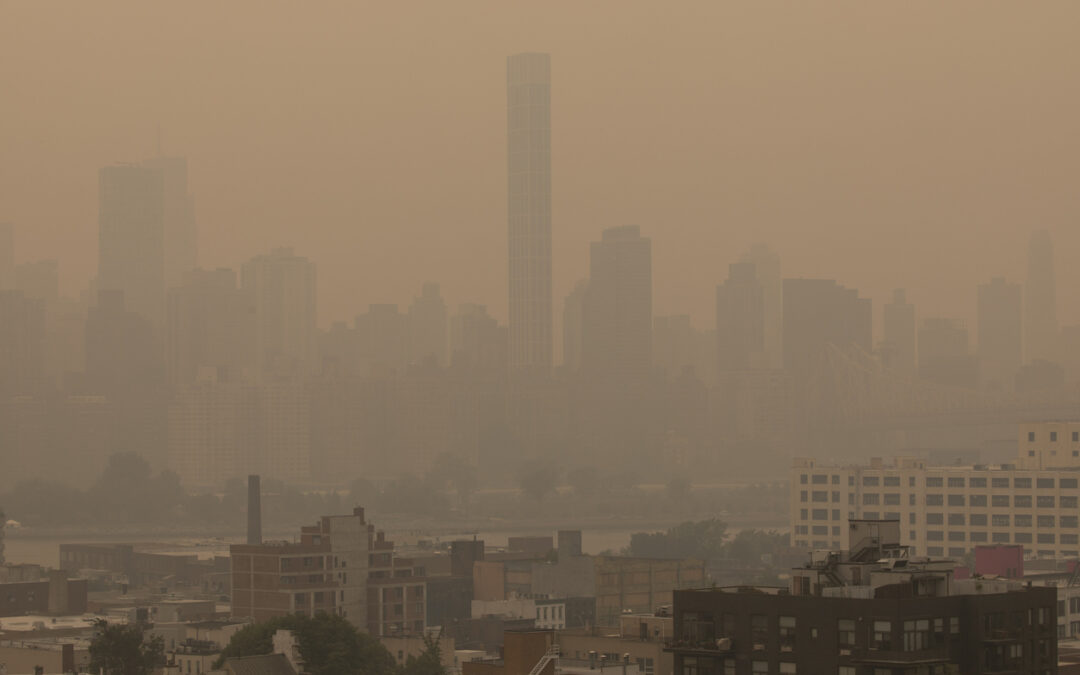
Exposure to Polluted Air
Communities of color are disproportionately exposed to emissions from heavy-duty diesel vehicles due to the location of arterial highways, commercial waste routes, delivery routes, and parking facilities for medium and heavy-duty fleets. These communities also experience observed health disparities, with EJ Areas sustaining the greatest levels of pollution-attributable emergency department visits.
Stationary sources of pollution, including “peaker” power plants, waste processing facilities, and hazardous waste generators, are disproportionately located in and around EJ Areas.
Exposure to Hazardous Materials
Hazardous waste generators and storage facilities, including large facilities and chemically-intensive small businesses such as auto shops, are predominantly located in EJ Areas. These facilities can emit hazardous materials that can pose adverse health effects to exposed populations.
Federal and state Superfund cleanup sites are established based on environmental and public health concerns. Brownfield cleanup projects are typically driven by the real estate market and area-wide rezonings. As a result, brownfields addressed under local and state government oversight tend to be concentrated in areas that have been rezoned and are undergoing large- scale redevelopment or are localized city-driven projects or infrastructure. The locations of these cleanup sites therefore do not necessarily reflect the distribution of land contamination across the city. There is no public data on cleanup work done privately.
Access to Safe and Healthy Housing
The legacy of discriminatory housing policies impacts housing conditions for today’s EJ communities. Neighborhoods reporting the most housing maintenance deficiencies and lead paint violations are disproportionately located in historically redlined EJ Areas in the Bronx, Central Brooklyn, and Upper Manhattan, compared to non-EJ Areas.
Nine out of 10 neighborhoods with the highest incidents of three or more maintenance deficiencies in renter households are EJ Neighborhoods.
Exposure to Hazardous Water
New York City has approximately 14 miles of swimming beaches that serve around 7 million swimmers per year, and many of its waterways are suitable for boating. However, many of the waterways within and surrounding New York City are impaired or stressed and limited for swimming due to a number of factors including water quality, current, and boat traffic.
Black residents are overrepresented among the census tracts with an above average number of confirmed sewer backup complaints.
Exposure to Climate Change
Most of New York City’s population living in neighborhoods with high heat vulnerability (HVI-5 and HVI-4) live in EJ Areas, particularly in Central Brooklyn, Upper Manhattan, Southeast Queens, and the Bronx.
The population living in the city’s EJ Areas is disproportionately exposed to flooding due to coastal storm surge, chronic tidal flooding, and extreme rainfall in the current decade. If EJ Areas remain the same, current hazard forecasts for the 2080s suggest that this disproportionate exposure to flooding due to coastal storm surge and chronic tidal flooding could persist.
Climate change will impact the lives of all New Yorkers, but existing environmental inequities can make residents of EJ Areas more vulnerable. For example, neighborhoods with the lowest rates of air conditioning at home and high heat vulnerability are concentrated in EJ Areas, and six of the top 10 neighborhoods in New York City with the least tree canopy coverage are EJ Neighborhoods.
You can access the full report here.